About kariann1237

Fun-loving, free-spirited, responsible professional. I guess I'm many things! I work remotely as a clinical trials project manager for a medical device company. I love traveling & festivals, gardening, cooking, hiking, backpacking & my two adorable cats. I love life!

Finding Hovenweep

Waking, I knew today was going to be a much better day! My day started by taking Geb out for a walk. I hadn’t gotten to take him for a walk the evening before because it was totally dark by the time we finally made it to the RV Park. He reminded me right away that I had promised him the night before that I’d take him in the morning. It was such a nice relaxing way to start the day. There was a sagebrush & juniper field just beyond the RV Park that we walked through. I just love watching him explore. Then, when I got cold I told him it was time to go home & he just turned around & took us back to Sofia. Wow! He had done that a couple days earlier when we walked at Nizhoni campground & then this morning too. Really, at the risk of sounding like a crazy cat lady… I believe he really does understand what I say!

After our walk I used lots of soap & hot water & cleaned up all the olive oil & soy sauce mess from the day before. You know, I don’t really like staying in RV Parks – I’d much rather stay in the middle of nowhere by myself – but I have come to realize while owning Sofia that RV Parks really do have a place. They’re super convenient. They have water, power, sewer, showers (Sofia only has an 8 gallon hot water heater), laundry facilities, and often even propane. Sometimes its nice to quit “roughing” it & use the amenities. Its certainly easier to clean up a mess having unlimited water rather than worrying about running out.

Work went well that morning; I got quite a bit done which always feels great. I was to check-out of the RV Park by noon, so my plan was to take my “lunch break” exploring Edge of the Cedars State Park & work the rest of the afternoon in their parking lot.

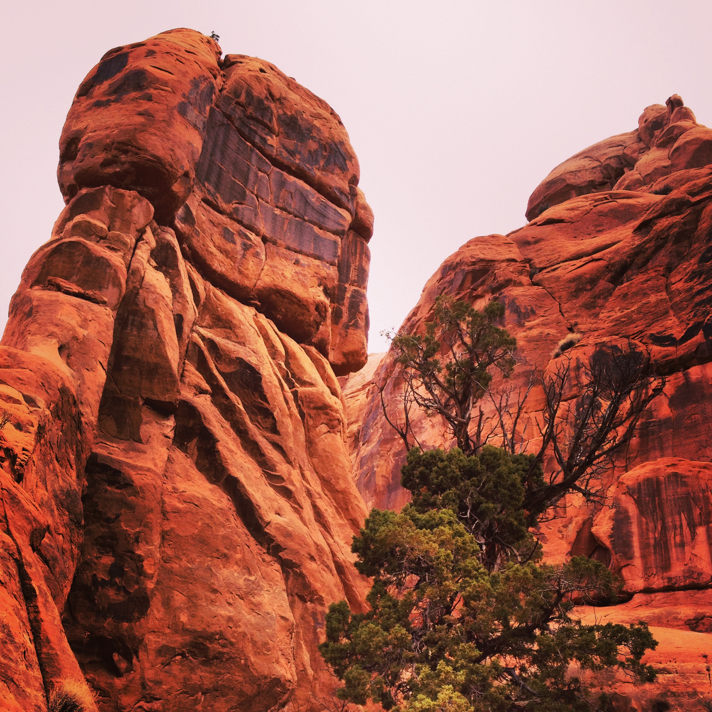
Edge of the Cedars is actually a really cool little museum. It has some Azasazi ruins outside, built from AD 825 – 1125. You can climb down a ladder & go into the kiva (ceremonial space). I found it interesting that they chose to build on this small hill. It was a great view with the mountains in the background & the valley down below. Pretty much the same view I had the previous day as I was working.

Ruins at Edge of the Cedars State Park

Ruins at Edge of the Cedars State Park

But the really fascinating thing there to me was their museum. They have the largest collection of Ancestral Puebloan pottery on display in the Four Corners area, as well as all kinds of artifacts – aprons from yucca fiber, turkey feather blankets (who knew they made turkey feather blankets!), sandals, arrowheads, digging sticks, etc. Such old cool stuff! And, they had all these informational signs about all the different ruins in the area and the stories of those who had discovered them.

It was fascinating… especially for someone who has ALWAYS dreamed of finding just ONE arrowhead (I never have been that lucky!). I can only imagine stumbling upon an entire ruin that no one has previously ever cataloged. I was blow away with really how many sites there were – all over the area! I guess I just had never thought about it before, but really there were ancients all over this area; not just at a well-known place like Mesa Verde. Perhaps that’s showing my ignorance, but I was happy to learn an overview of so many local sites. While I was there, I saw an informational board on Hovenweep. I was instantly drawn to it & knew that was the next place I was going.

I finished up work & conference calls that afternoon. I couldn’t wait to get on the road & drive toward Hovenweep! Even just the name seemed magical to me in a tragic sort of way…

Even though I had seen a brief informational sign about Hovenweep, I didn’t really know what to expect. Again, arriving late in the day, there were only 2 cars in the parking lot other than Sofia & the visitor’s center was closed. I found a trail that pointed toward ruins & walked out. I arrived at a smallish (comparatively) canyon cut in the middle of the Cajon Mesa & saw not only one tower, but a lot of them! Oh, how fascinating!

There are towers on top of huge boulders, on the sides of cliffs, under overhanging rocks, & at the canyon bottom all made out of stone. There were little windows & doors even! Its difficult to get multiple ruins in one picture as they’re spaced out all along the canyon.

Some of the towers at Hovenweep

Some of the towers at Hovenweep

They’ve determined that the village was constructed during the thirteenth century. Towers here are D-shaped, round, square, rectangular or the shape of the boulder top upon which they were constructed.

Tower on top of a boulder, Hovenweep National Monument

Tower on top of a boulder, Hovenweep National Monument

Researchers have even discovered that the windows & door locations in the Hovenweep Castle create a solar calendar indicating the dates of summer & winter solstices and the spring & fall equinox sunset. Amazing.

Hovenweep Castle

Hovenweep Castle

Hovenweep is a Paiute and Ute word that means deserted valley. This place was given that name by a pioneer photographer, William H. Jackson in 1874. In 1923 it was established as a National Monument. It is what archeologists consider to be the finest examples of ancestral Puebloan masonry found anywhere. It was once a vibrant community of hundreds.

I could just feel the presence of the ancient people here. It felt like a reverent place to me. I wandered all around, all alone in this amazing place. Such history!! I sat on a rock ledge at the top of the canyon. I can only imagine what it would have been like 1,000 years ago. There were people living there who were probably not that much different that we are today. People, who laughed & smiled. Who had hardships & difficulties. Who loved & lived. Of course, their hardships were different than ours today, but the fundamentals I’m sure are similar.

As I sat looking down at the relics of this ancient community, there were two ravens circling above back & forth, up and down, the canyon. I bet they too could tell this is a special place…

The canyon is “Y” shaped. The tops of the canyons just abruptly start; cliff-faces down to the canyon below. Not terribly high, but strangely abrupt. I bet it would be amazing during a rain storm or flash flood to see the water from the mesa cascading down the cliff to the canyon below.

There is a spring at the top of the left canyon. There are trees growing up gracefully. I realized that those trees obviously weren’t there 1,000 years ago, but I bet other trees were. How lovely it would have been to relax in the hot summer day down in the shade of those trees. There were not any buildings at the top of the right canyon. I wonder if that was where they used to go for special outdoor ceremonies. At least that’s what I imagined. My mind just wandered, making up little stories of those who used to live here… It was a lovely way to spend the evening as I watched the sun begin to set.

Advertisement

Not my Day

Waking up Monday morning, I tried getting a good internet connection so I could work to no avail. My phone said I had 3G & 3 bars, but it wasn’t happy at Nizhoni campground. So I drove back down the long gravel road toward Blanching. There was a wide pull-out spot maybe 4 miles or so outside of town. It was up on the mesa with a view of the Abajo Mountains on one side & the entire valley below stretching all the way beyond Monument valley to the south. It really was a spectacular location to work for the day.

Beautiful work view - Abajo Mountains

Beautiful work view – Abajo Mountains

However, it was just one of those days… I suppose everyone has them once in a while. Where your mind obsesses over something & won’t let it go. I all of a sudden was preoccupied with a conversation I’d had days prior. Goodness. Insecurities will do a number on you if you let them that’s for sure. Anyway, I told myself I was getting myself out of my funk & going to see the sites. I was down here on this trip & I wasn’t going to let myself get in the way of enjoying it!

So I headed away from my beautiful little roadside spot after I got my work done that day. But, it just was NOT my day! The very first major corner I came to coming back into town, I heard a crash behind me in the kitchen. Damn… I had forgotten to put my kitchen box in the sink where it typically rides as I drive. I keep things like olive oil, soy sauce, balsamic vinegar, spices, teas & coffee in this box and had mistakenly left it on the counter. Well, now, it had crashed all over the floor! Olive oil, soy sauce & wine everywhere! What a mess…

I pulled off the road & did a quick clean-up job, but realized I better stay in a RV park that night so I could actually do a good job cleaning, using lots of water, to clean up all the olive oil.

But, I wasn’t going to let that mess stop me either! A girl on a mission, I was headed to Natural Bridges National Monument. One of the nice things about working all day & taking in the sites in the evening is that you’re not competing with the crowds at all. Maybe there just aren’t any crowds this time of year, but regardless… its kind of cool to be in a National Monument pretty much all by yourself. I probably only saw about 8 other people the entire time I was there.

The only person I talked to was a guy from Germany. I saw a road bike loaded with gear in the parking lot & saw a guy on the trail who looked like he belonged to the bike at the first bridge. I ran into him again at the third bridge. This time we stopped & chatted as we recognized each other. He’s road biking all over the west with hopes to make it to Alaska! My gosh… way too extreme for me! I think I got a kick out of his adventure stories & he got a kick out of me working in Sofia & traveling with my cats.

There are three huge bridges that make up the Natural Bridges area and some cave dwelling ruins as well. It has a circle drive you go on to view the three bridges, but its not a well-developed park. Each bridge has a short trail you can hike on to get a better view of it or you can hike all the way down. As it was evening & my foot was still hurting from the little crash with Zeta, I didn’t want to hike all the way down, but I did hike out to the viewpoint on each trail.

The trail to the viewpoint for the first bridge, as mentioned, wasn’t too developed. I actually kind of like it that way!

IMG_4282

IMG_4283

The first is the Sipapu Bridge; its 220’ to the underside of the arch & 268’ wide.

Sipapu Bridge

Sipapu Bridge

The second is Kachina Bridge; its 210’ to the underside of the arch and 204’ wide.

Kachina Bridge

Kachina Bridge

The third is Owachomo Bridge; 106’ to the underside of the arch and 180’ wide.

Owachomo Bridge

Owachomo Bridge

I couldn’t get a good picture with my iPhone, but the Horsecollar cliff-dwelling ruins were there in the canyon as well, dated from between AD 1050 – 1300. That was a cool surprise to see!

After seeing the sites at Natural Bridges, I thought that maybe, just maybe, I could make it out to the top of Moki Dugway to the Muley Point Overlook to see the sunset over Valley of the Gods. The road to the top turned off of the road I was driving on back to Blanching. Might as well try I figured.

It was a race against time again, much like last summer when I was racing to get from Cannon Beach to Neah-Kah-Nie Mountain for sunset. This time, rather than down the winding Highway 101 of the Oregon coast, I was barreling along the top of Cedar Mesa, out Highway 261. As I drove, I considered the word, barreling. It’s a pretty accurate description of how it feels driving Sofia across those back rural highways. In my mini I always feel like I’m zooming or zipping along. In Sofia, its barreling, gliding (albeit not gracefully) over all the bumps, around the corners, rattling & clanging down the road. I guess if I didn’t have disco ball chains hanging inside Sofia as well as random pieces of metal art that say things like “Dream” & “Be Yourself! Everyone else is taken” it wouldn’t rattle & clang so much. LOL!

Finally I made it to the top of Moki Dugway. I was planning to park Sofia there & take Zeta out to the overlook. But, as it would be, it just wasn’t my day… still! The sun had just set as I was racing along. The valley below was all in shadows. Wasn’t meant to be. Next trip, I’ll make it to the overlook in time to watch the sunset!

As mentioned before, I don’t really like driving in the dark to begin with… once the sun set, my goodness did it get dark quick! I was still 65 miles or so from Blanching. Onward! I at least knew which RV Park I was headed to that night. Once I arrive, I found a spot (the office was obviously closed) & parked. I was glad that I had made it out to see the sites, even with the difficulties of the day. Some days are just like that I suppose.

That evening, I talked to a friend about the conversation that had been preoccupying my mind all day & realized just how ridiculous I was being. My goodness… thankfully, there are people in our lives that can help us see things about ourselves; room for growth. It’s a learning process I think & certainly hope I’m learning these lessons so I don’t have to repeat them.

After a day like that, I was happy to crawl in bed & call it a night!

A Not-Quite-Relaxing Meander through Valley of the Gods

Mom & I just had the morning together before she was leaving to drive back to Prescott. Since we had seen so much of Monument Valley already, we decided to venture out a little farther. We drove both Sofia & mom’s rig to Goosenecks State Park. Goosenecks provides a vantage point of the San Juan River winding its way 1,000 feet below. It meanders over six miles in just a mile and a half.

Goosenecks State Park

Goosenecks State Park

After snapping a few pictures of the river below, I convinced mom to go with me up the Moki Dugway. I had heard that the view of Valley of the Gods from the top of the dugway was beautiful & shouldn’t be missed. The road is said to be a crazy unpaved series of switchbacks carved into the face of the cliff edge of Cedar Mesa that climbs 1,200 feet in less than 3 miles. There are big warning signs leading up to it stating 11% grade, not recommended for RV’s, etc. I knew it wasn’t a road I wanted to take Sofia on!

The road was actually in pretty good condition; I’ve been on worse switchbacks in my life. And, the view from the top was beautiful. Although, it was just about mid-day, so a poor time of day for photos. I decided to try to make it back later in my trip for a sunset view. (There is back way to the top of Moki Dugway that I could take Sofia on.)

Looking down at Moki Dugway

Looking down at Moki Dugway

Back down the grade and to Goosenecks, we gave each other a big hug. So happy we got to share this quick weekend together! Mom headed home & my next plan was to take Zeta & explore Valley of the Gods.

It was a little cool outside & I realized that riding a scooter would most likely be much colder with the wind factor. So, I layered up – leggings under jeans, a warm sweatshirt over a t-shirt, and my warm wool coat. I only had knit gloves with me, as I forgot my leather ones at home. I added my helmet & felt like I was as ready as I was ever going to be…I managed to manhandle Zeta down the ramp again, all by myself! Then, pushed the start button & vroom! She started right up! Thank goodness.

“Well, here goes nothing” was the thought that went through my head as I headed out on my first real ride on Zeta. I guess its not too difficult to ride a scooter; much easier than a motorcycle I imagine. But at this point, I was kind of wishing it hadn’t been such a snowy winter so I could have possibly had a few practice rides under my belt! The first several miles were paved getting from Goosenecks to the Valley of the Gods turn-off road. As I drove, I realized that anything above 35-40 mph was just too fast for one thing, but also too windy & cold! I also wondered, as I drove, why I thought it was a good idea to leave Sofia at Goosenecks?! Why hadn’t I drove Sofia to the Valley of the Gods road? Silly me! Oh well, onward I went!

As I drove along, I realized that this whole riding a Vespa thing wasn’t quite the romantic notion I had imagined when I bought her… Below is the image I had in mind. LOL! In reality, it wasn’t like this at all!

My romantic notion of what Vespa riding would be like...

My romantic notion of what Vespa riding would be like…

I was very cold by the time I reached Valley of the Gods, but I knew once I was driving slower on the gravel road I wouldn’t have nearly as much wind & wouldn’t be nearly as cold. I was actually pretty grateful to get off the paved road so I could feel OK slowing down.

The landscape in Valley of the Gods is quite a bit different I think than Monument Valley. There are more features that look to me like eroded mesas, with cliffs up above, then the terraced layers below, where Monument Valley seems to have quite a few features that are sheer-type cliff-faces. Still quite spectacular.

Valley of the Gods Panorama

Valley of the Gods Panorama

I was cruising along at about 15 mph (much more my speed!) and feeling very proud of myself. This wasn’t so bad! The gravel road I was on is a 17-mile drive through the valley. Coming up a little hill, I saw the perfect spot for a photo shoot to document my 1st real ride on Zeta. Cliffs in the background, red dirt & some sagebrush in the foreground, it was great!

Zeta photo shoot!

Zeta photo shoot!

Not quite the romantic notion, but smiling nonetheless...

Not quite the romantic notion, but smiling nonetheless…

Wouldn’t you know, not ½ mile later, there was a really steep (albeit short) hill with the road kind of washed out at the bottom. It was VERY uneven & rocky down there. Of course I slowed down going down the hill, but perhaps that wasn’t the right thing to do either. LOL! I totally psyched myself out! Arriving at the wash, I promptly tipped Zeta over… right on to my right foot. Damn, she’s a heavy scooter! I was like, really?! That’s what I get for over-thinking things. Probably would have totally been OK if I would have trusted both Zeta & myself & just sped on over. The good news is that I was pretty sure I hadn’t actually broken or sprained anything. I was going SUPER slow, so it all kind of happened in slow-motion anyway. And, Zeta only had just the slightest scratch on her front fender. “Thank goodness I already did Zeta’s photo shoot”!

I tipped Zeta back up & hobbled as I pushed her out of the worst part of the wash. Thank goodness, she started right back up. I was afraid the carburetor or whatever was going to be flooded after being on her side. Well, there I was, only about 3 miles or so in on the drive… As I learned as a kid with my horse, what do you do when you get bucked off? You get right back on. And so I did.

I’m very happy to report that the rest of the drive along the gravel road through the beautiful Valley of the Gods was pretty uneventful. There were several times when I was white-knuckling it down some (IMO) steep hills. But, I managed. I stopped several times along the way, hobbling around to take pictures. The road about ½ way through is very close to the cliffs & very spectacular.

Castle Butte, Valley of the Gods

Castle Butte, Valley of the Gods

The funny thing, though, is, I kept wondering to myself why I hadn’t just taken Sofia on this road?! She totally would have made it. Although, of course, I didn’t know that the road was passable in Sofia until I had driven it on Zeta. And, I definitely didn’t want to repeat my mistake from last summer in the Redwoods & take Sofia somewhere where she shouldn’t be. That was REALLY scary!

I moseyed along… definitely enjoying the view. There are not a lot of people this time of year in Valley of the Gods… I probably only had 5 vehicles pass me on the whole road & only saw one campsite occupied.

Cottonwood Tree,  Battleship Rock & Rooster Butte, Valley of the Gods

Cottonwood Tree, Battleship Rock & Rooster Butte, Valley of the Gods

There were so many awesome places I could just imagine pulling Sofia over & camping for the night! I resolved to camp at least one night in Valley of the Gods during this trip. I think it would be especially magical to watch both the sun set & rise within this valley.

17 miles later, I finally arrive at the highway; the end of the gravel road. I was faced with a dilemma. Do I go back 17 miles on the gravel road that I had just survived or do I attempt at riding on the highway? Highway 191 is a much busier road than the side road I originally drove on between Goosenecks & Valley of the Gods. I weighted my options. I was pretty tired. Who knew riding a Vespa would be so tiring! I just couldn’t imagine driving back down all those hills I had come up. And, so, to the highway I went.

“Let’s do this!” is the pep-talk I was giving myself as I pulled out on to the highway. Of course, I ensured there were no vehicles around, but just a few yards down the road, an SUV roared up behind me, swung around me (I still am only going 40 mph) & left me in a wind gust. Whew! Not only did the passing vehicles leave wind gusts, but the wind was really gusting too. Yikes! I really DO NOT like riding in wind gusts. I felt myself getting more & more tense and realized that I needed to relax. I had seen this happen so many times with inexperienced riders on horses. The more tense they got, the more difficult the ride. But, I tell you… riding horses is BY FAR easier!!

“Relax, calm-down, relax”, I kept repeating this mantra as I (in my mind) fought the wind gusts trying to stay upright. Its funny how hard it really is to try to relax yourself in the middle of a really stressful situation. Thankfully, it really wasn’t too far… probably only about 6 miles to the turn off to the paved road back to Goosenecks, then only about 4 more miles or so. But at only 40 mph it seemed forever!

Seeing Sofia parked in the distance was such a happy site to see! I felt completely drained by the time I arrived, both physically & mentally. And my foot still really hurt. All I wanted to do was to find a good spot to overnight in & go to sleep! I couldn’t stay at Goosenecks as I had to work the next day & there was no internet connection. But before I could leave, I had to get Zeta back up on her rack. I tried a couple of times, exhausted, to push her up. I couldn’t quite do it. I was so frustrated as I had managed to do so before. Thankfully a nice man from across the parking lot came over & offered to help. He said no sense in trying to do it myself when he could help me. I was so grateful. The good news is that I’ve finally figured out the tie-down straps, so those aren’t a problem anymore! Zeta secured, I started Sofia up & headed back up toward Blanching as I remembered having pretty good reception there. I also remembered there was a state park I thought I could camp at.

Arriving at Edge of the Cedars State Park, I saw it was just a very small state park with no overnight camping. Good lord… all I wanted to do was call it a day! I consulted my map & saw there was a National Forest campground between Blanching & Monticello.  Back on to the highway I went. But, then I saw a sign. Another national forest campground. Perhaps I had missed it on the map, but “obviously” it was closer. Why not? Turning on to the road, I saw a sign that said 12 miles to Nizhoni Campground. I didn’t really think about what it meant by driving 12 miles up into the national forest at this point. And, so I drove and drove… you can’t really go that fast on a winding uphill gravel road in a big RV. Finally, as I’m passing snow bank after snow bank & suddenly start driving over residual snow banks over the road, I’m wondering, what am I getting myself into AGAIN?! I turn a corner & see this sign…

Not the sign I wanted to see...

Not the sign I wanted to see…

Of course, that’s the road I’d find myself on. The road is probably delayed due to snow banks that need melting! But then I saw the sign for the campground. Yippeee! I had made it! I parked Sofia right at the entrance & walked in. All the camping spots still were covered in snow. I knew I definitely wasn’t going to make the mistake of getting stuck in a snow bank. I saw just down from the main entrance, the parking area for the picnic section and knew that would be the perfect spot for the night. It didn’t matter that it wasn’t level. At least it was off the road & safe. I backed Sofia down to the spot, not wanting to get down there & not be able to get turned around. See, all the past experiences are making me wiser!

As soon as I parked, Geb was asking to go out for a walk. I had promised him in the morning I would take him for a walk that evening. I poured myself a glass of wine, put his harness on & we went out to explore the campground. Of course we were the ONLY people there. LOL! I didn’t even pay, because who would ever know I was up in the middle of nowhere… My foot was starting to feel a little better, but still hurt to walk on it. I saw that there was a trail to some Indian ruins about a mile from the campground, but I wasn’t in any condition to walk that far. And so, Geb & I just wandered around. It was so fun to just be outside, in the forest, in the middle of nowhere watching Geb explore. I love letting Geb lead the way on our walks. Its amazing to get a tiny glimpse into his brain and see how he goes about investigating the world around him. Quite fascinating to see the paths he takes, the bushes he stops to sniff.

Mr. Investigator, Geb

Master Investigator, Geb

Which way do I go?

Which way do we go?

On our walk...

On our walk…

Finally, for the first time all afternoon I felt like I was able to relax. The forest to me is always comforting. I love listening to the wind in the trees & the birds. Seeing the fading sunlight flickering through the branches. Smelling the pine, juniper, sage & humus. Such a calm & peaceful place to be.

Through Monument Valley

The drive south from Moab was such a beautiful one. After the red rocks just outside of Moab, there were the Abajo Mountains outside of Monticello & Blanding. Beyond that I could begin to see Monument Valley in the distance. Even from a distance, it just looked so awing and got even more so the closer I got to the area.

There is one RV Park in the valley, Gouldings Resort, inclusive of a lodge, restaurant, campground, mini-mart, & gas station. Monument Valley is on tribal land, so you can’t just park & camp wherever.  Gouldings Resort is situated right beneath towering red cliffs with spectacular views of Monument Valley. My mom had arrived just before I did & found me just as I got there. We checked in quickly & left Sofia, using mom’s rig as we figured it would be easier to get around. The Gouldings resort has a small little museum. The Gouldings were some of the original settlers in the area who established a trading post to trade with the natives. Later, during the Great Depression, they were instrumental in getting the movie industry started in the valley, which definitely helped the economics of the area. The museum has quite an extensive photo collection of all the movies filmed in the area, as well as some native art, rugs, baskets, etc. Also, their living quarters which were above the trading post were open for viewing. Pretty cool to see. Obviously John Wayne is a pretty big deal in these parts. His “cabin”, I think from a movie set, is located right behind Gouldings trading post which has his picture painted on the side of the building. Not much to see there, but it was kind of fun to be in the same place as John Wayne was.

The Duke

The Duke

Mom & I had decided the best way to view the sites of Monument Valley was a guided tour. As mentioned, the land is tribal land & they don’t like randoms driving all over the place. There is a “17-mile drive” through the valley that anyone can drive on, but based on internet research, the true gems were on the guided tours. The tour through Gouldings that I wanted to go on didn’t start until April. So, I looked around the internets & found a website for Kéyah Hózhóní, Monument Valley Tours (I highly recommend calling them if you’re headed to Monument Valley!). I was drawn to the photos on their site & after sharing it with mom, we booked a tour.

We met our tour guide, Ray, at 3:30 after touring the Visitors Center at the Navajo Tribal Park. Just the views from the visitor’s center were amazing, but we were ready for more! As things ended up, Ray, couldn’t have been a more perfect guide! As he drove us around, he told us stories of his grandmother, the current medicine woman for the Navajo Nation. He told us of a documentary she & he are in; mom & I both made notes to watch it sometime. Its called “We shall Remain – the Navajo”. He showed us where Andrew Zimmern & Bizarre Foods filmed the segment featuring the Navajo Nation. That was super cool, because I remember watching that episode! He explained the differences between a male & female Hogan. The only difference is the shape & way its built. Both males & females & kids for that matter can live in either a male or female Hogan. All hogan’s have the door facing east, so they can welcome the sun each day.

And, to top it all off, Ray often guides photographers. So, at each stop, he’d show me (sometimes it was quite a hike!) where all the photographers go to get “the” shot & when the best time of day & year it was to get the best shots of each feature. I even opened up the Monument Valley souvenir book I bought & the first picture was one exactly the same location & angle that Ray directed me to take. I love it! How fascinating to listen to his stories both of the natives as well as all the photographers he’s guided. He really was such a charming host for us through the backcountry of Monument Valley.

Here are some of the pictures from our tour with Ray…

Me & my mom!

Me & my mom!

Wild horses - I love that the stallion just stood there & posed for the picture. :-)

Wild horses – I love that the stallion just stood there & posed for the picture.

Sun's Eye Arch

Eye of the Sun Arch

Anasazi pictographs

Anasazi pictographs

Ear of the Wind Arch

Ear of the Wind Arch

Star Wars-like rock

Random Star Wars-like Rock

Pancake Rocks & the "Dragon"

Pancake Rocks & the “Dragon”

Big Hogan Arch - super cool cave arch that was round with the opening in the very top middle. Super cool!

Big Hogan Arch – super cool cave arch that was round with the opening in the very top middle. Super cool!

Yei Bi Chei (The Dancers), The Totem, Tumbleweed, & Ripples in the Sand

Yei Bi Chei (The Dancers), The Totem, Tumbleweed, & Ripples in the Sand

The Dancers & Totem

The Dancers & Totem

Monument Valley Panorama

Monument Valley Panorama from John Ford Point

By the end of our tour, we were just in awe of the breathtaking landscapes we had seen. What a magical place indeed…

We were also very hungry. We went to Gouldings Lodge (recommended by Ray) for dinner and had the best stew & fry bread ever! I had Pork Green Chile Stew & mom had Beef Stew. Excellent southwestern cuisine!

Returning to Sofia, I remembered that I needed to deal with installing the battery in Zeta so it could charge overnight, as I wanted to take her for a ride through Valley of the Gods after mom left the next day. Now, I have NEVER worked on any type of vehicle doing anything ever. Installing a battery might not seem like a big thing, but it was a little daunting to me. Especially beings that the battery wasn’t the exact duplicate of the one that was previously in there. This new one was shorter & wider than the original. Thankfully, I was able to somehow wiggle it in the allowable space, all the while keeping track of the wires. I connected it all & just like that! I had done it! I connected the battery charger & figured I deserved a nice glass of wine after that!

Although then once I got back in Sofia, mom mentioned that the carpet was all wet in the bedroom closest to the bathroom. That damn leak; the one the repair guy couldn’t find! A thorough investigation showed that the leak was coming from the water lines leading to the toilet. I tried tightening them to no avail thinking they might just be loose. I was like, really?! More problems on this trip already? I got a towel & soaked up the water all around. Mom found a cup that we placed under the leak. The problem was the cup was filling up full in like 20 minutes! I tried researching the internets for a solution, but then turned to the owner’s manual. It appears as though I didn’t winterize the toilet correctly & resulted in cracking the water valve. Only solution is replacement. Ug. What was I going to do for 9 more days leaking this much water? Mom, the ingenious person that she is, suggested turning off the water to the toilet. There isn’t exactly a turn-off knob like in a home bathroom, but then I remembered the water pump! Turning that off, helped slow the drip tremendously. Short-term solution; yes! Pretty easy to leave the water pump off except for briefly when needed. Ah, yes; always good to find those creative solutions for random things that happen on an adventure.

All the upkeep items aside, mom & I could finally relax & enjoy the rest of our evening together. A couple glasses of wine & looking at all the fun pictures we took earlier in the day – the perfect mom & daughter time for us!

On the Road again…

I had been planning to take a trip to southeastern Utah last fall. We ended up getting a very early snow storm the first week of October, which had me reconsidering. I didn’t want to be driving Sofia all over Utah in the middle of a snow storm! So, I decided to postpone until spring. My company gives us one “Spring Break” holiday day, which this year is Friday, March 29. I thought it would be great to use that as one of my days down in southeast Utah as I would have more free-time to explore.

So, I was set on the days for my trip, but before I left, Sofia needed a quick visit to Camping World to fix a few minor things that needed done from our adventures last summer. I also needed to figure out how to get Zeta running & registered. The problem was that it kept snowing in SLC! There was a huge snow pile behind Sofia. There was no getting her out until about a week prior to leaving. Once the snow melted enough, I loaded Zeta on the back & took her to the Motorcycle Doctor for new spark plugs & whatever needed to happen to make her start. I got her back on Thursday afternoon, the day before leaving, with just enough time to run by the DMV for registration. I didn’t even have time to try to start her once I got home, as the guy from the repair shop told me to charge the battery overnight again. I also managed to take Sofia in this week. The repair guy reported he couldn’t figure out the leak I was having & instructed me to watch for it to see if I could narrow down where it was coming from. Great…

Friday was a hectic day at work as I did annual reviews for all my employees. Finally I got done with those meetings & was able to throw all the last minute things into Sofia & hit the road. It felt so great to be back on the road again… As I drove, I was again reminded how beautiful it is to watch sunsets. Of course, I’ve seen sunsets over the fall & winter, but never have I taken the time to watch an entire sunset from beginning to end since the last time I was driving Sofia in the evening. It really was a beautiful sunset.

I arrived at Melissa’s house in Moab right around 9pm. I was thankful I had gotten out of town when I had as I didn’t have to drive in the dark for too long. I don’t really like driving in the dark outside of a city in my car, let alone Sofia! Melissa had a fire performance that evening; I was going to ride Zeta over & meet her there. I even managed to get Zeta down the ramp all by myself! A little scary, as she’s MUCH heavier than I ever anticipated when I purchased her sight unseen online! I had help getting her up on the rack to take her to the repair shop & the repair guy got her back up there for me. Anyway, I was ready to take her for her first real ride.

I turned the key on, held the brake, pushed the start button, and… NOTHING! Seriously?! Tried again a few times, still nothing. I was cursing the guy at Motorcycle Doctor by this point. A little research on Google (where would we be without Google!) suggested that I replace the battery. I had high hopes that the Moab Napa Auto parts store would have the appropriate battery. And, so, I didn’t make it to the fire show. I did, however, have an awesome rest of the evening once Melissa got back, hanging out & chatting with her. Its always so fun to share an evening with a soul sister!

The guy at the auto parts store the next morning was SO helpful! He came out & unhooked the battery, showing me how to do it. He didn’t have the exact battery in stock & after calling around town, no one did. Lovely… But, he did sell me one that he said would work & sent me on my way with instructions on how to install it once I reached the RV park that evening. It was kind of funny; he asked how I was enjoying my Vespa. I replied that since I had never been able to start her & had never really ridden her other than for a couple blocks around my house, it was basically just irritating at this point.

Back on the highway, heading south to Monument Valley where I was to meet my mom at noon. She got the day off & was driving up from Prescott, AZ to meet me. We were both excited that we could do that! I knew I had a little room in the schedule to stop for a few pictures along the way. My first stop was Kane Creek rest stop, just to take pictures of the beautiful rocks. I love the rocks in the Moab area!

Kane Creek

Kane Creek

I next stopped at Wilson Arch. Wow! So cool that such an arch was just right there, right along the highway. I hiked up & through the arch. A very steep, but fun little jaunt.

Wilson Arch

Wilson Arch

My next stop was a “Viewpoint” outside of Canyonlands National Park. I saw the sign & thought, I’m always saying to myself that I want to take advantage of these types of things & get some good pictures. So often I’m in a hurry & never take the time to stop. And so, I parked Sofia, got out my camera and switched lenses to my telephoto lens. Then, I opened Sofia’s side door & of course, didn’t wait for the stairs to come out, I just jumped right down. Great plan until, the sleeve of my sweater caught on the door latch. It was the hand I was holding my camera in (and yes, of course, I didn’t have the strap around my neck). It all happened in such a split second! I dropped my camera. L It crashed down very hard onto the asphalt below. I looked down & the lens was in two pieces. SO SAD! I was shaking a bit, as accidents like that have that effect on me… I picked up the pieces of my lens & the camera body. I figured I could just change to a different lens & things would be fine.

I did that, carefully walking down the stairs this time. I got out to take the photo & my camera wouldn’t work! The fall must have knocked something loose inside. The shutter button wouldn’t depress & I kept getting an error code. Now I was REALLY REALLY SAD!!! Here I was at the very start of my 10-day adventure to take pictures of beautiful southern Utah with NO camera. L I had broken it before the first shot was even taken! I remembered that my iPhone actually takes pretty good pictures, so I was somewhat consoled that I would still be able to take some pictures. I am still pretty sad about the whole broken camera & lens thing; am hoping the camera repair guy can at least fix the camera body. The lens definitely will be needing a new one for sure.

However, I wasn’t going to let that little setback get me down. I got back on the road again; calming down & spirits improving the farther south I drove.

Among the Giant Trees

Awake before dawn, I sleepily got in the driver’s seat & headed back to the little beach wayside in Crescent City by the lighthouse. I did manage to make it out of my overnight “hiding” spot before anyone inquired. Once it got to be daylight, I took Geb out for a walk as has become our routine in the mornings. I wanted to walk over to the lighthouse so I could take a good picture. Geb was such a little trooper! He totally walked the whole way there & back, across the rocky beach. His little paws were so wet, but he was having so much fun!

So cute!

The beach wayside was a perfect spot to work & rest that day. It was such a pretty spot, even despite the low-hanging gray clouds.

I went down to the National & State Parks Ranger Station during my lunch break. Those redwoods almost kicked my ass yesterday I figured I better get some expert advice. Come to find out, at the end of the jeep trail that I headed toward in the darkness last night, there really IS a RV park. My trusty iPhone app didn’t steer me wrong. Just the directions app that it sent me to did. The map the rangers gave me said in nice bright red letters “No RVs or Trailers” on that road. Yeah, I guess that would have been nice to know! There is another way around to get to the RV park in Jedediah Smith Redwood State Park that is a nice windy paved road that is suitable for Sofia.

Returning to my little lighthouse wayside haven, I finished the afternoon. By 4pm (5pm MDT), I was more than ready to be done with my work day & tempt my fate with the redwoods again. I headed east out Hwy 199. What an incredible stretch of road. They really preserved the forest when they put in that road. I was so grateful for their foresight. Huge redwood trees standing there so close to the road that the sides of Sofia were almost brushing them as we drove slowly winding through the groves. I only had the one night to wander through the redwoods, so the ranger had recommended the Walker Road area.

Turning onto the graveled Walker Road, I quickly realized that the other section of the state park that I was in last night really wasn’t that much different than this area. Meaning, this forest park is still very wild. Even in 2012. The roads are really not developed. Signage is pretty much non-existent after the initial sign that said Walker Road. I was trusting that the ranger would not send me down a road I would have to repeat my turn-around escapade of last night! And thankfully, the roads weren’t quite as narrow.

Sofia in the Redwoods

I kept driving until I reached the Smith River. I hadn’t known there would be a river amongst those trees. I managed to find a spot to turn around & pulled over. I wanted to explore this magical place on foot. I grabed my camera & set off. Back up the road I drove in for a while and then changed roads to a smaller side road that branched off. I kept wandering off the road into the groves to see an extra big looking tree or a fallen log covered in moss that intrigued me well.

Mossy log & huckleberries

Crazy enough, the whole time I was by or walking along the road, only three cars passed by… for hours! I literally was alone out in those huge magnificent trees for hours.

I loved being amongst those trees!

Although, it was quite humbling to be just a girl wandering among those ancient giants. They felt so grand and so wise. It was very quiet in the groves, occasionally I’d hear a bird, but that was it. Not even any wind in the trees that day. I finally found a sign “Trail”. Of course it didn’t say where the trail went, but I followed it any way. It didn’t feel like I was hiking through there, no, it really was a meditative stroll, so serene and peaceful.

There was just so much to look at and take in. The trees themselves, from their height and girth, to their branches and needles, their bark with deep groves in it, some covered in mosses and lichens, some not. The forest floor is soft with sour grass, mosses and duff, hundreds of years of needles falling there, so rich and nutritious for the abundance of huge plant life there. The underbrush added to the tranquility of the forest with vine maples, rhododendrons, huckleberries, many kinds ferns, and salmon berries. I can only imagine how beautiful it would be when the rhododendrons are blooming; my next trip to the redwoods will have to be in the spring.

I saw many trees with old burn scars. Amazing how those old trees could weather such a fire & survive, but many of them did. Of course not all of them; I’m sure that’s why some were laying as logs covered in moss. I don’t know how many hundreds of years ago the fire happened, but only the rugged, huge old trees had burn scars. It made me reflect upon the difficulties in life. I guess the saying is true that says “what doesn’t kills you makes you stronger”.

I found wildlife in the underbrush as well!

As well as slugs, as I walked along I saw lots different varieties of shelf mushrooms growing on dead or dying trees.

Fascinating shelf mushroom

I was really excited when I found this incredible mushroom that was bigger than my hand spread wide! I still need to work on identifying it.

HUGE Mushroom

I also saw this parasol type mushroom that was huge as well; probably more than 10” across. I took its picture & admired it for a while, then wandered off to continue my exploration. Upon my return several hours later, it had fallen over, I’m thinking that it must have just continued to grow & had collapsed under its own weight. What a place this forest is with its giant trees and mushrooms!

Parasol Mushroom

And, finally, I found some mushrooms I could eat! Oyster mushrooms! They were way high up in a tree, but I have hunted these before and know how to coax them down from their lofty heights. I found a long stick & pushed up on their hold to the tree to break them loose. Works like a charm! The only difficulty was then finding them all in the dense underbrush, but I got them! They were delicious addition to my dinner later that night!

Dinner!

Walking along the trail, I found an old log that a bench had been cut into. It had a plaque in honor of Don J. Leiffer, May 31, 1925 – February 18, 1970. “Lover of Nature, People, and Life – He burned his candle at both ends… and it made a wondrous light.” That saying is inspiring to me… don’t just be busy with life, but make something wonderful out of the busyness. Further down the trail there was another plaque, “Walk wonderingly through the forest and experience the joy of discovery.” – Dorothy and Murray Leiffer Grove. I smiled when I read that as I had spent the last several hours doing exactly that!

As I wandered, I reflected on the book that inspired me to come back to the redwoods. I had visited the giant trees when I was a kid with my family, but hadn’t thought much of them since. Then several years ago, I found a book called The Wild Trees. I highly recommend it to anyone interested in nature. Its all about the first people who learned how to climb the redwood & giant sequoia trees and about the entirely different ecosystems that they found up there. Truly fascinating! Ever since reading and rereading that book I’ve wanted to come back, just to wander among these majestic trees.

Its not called “Adventure” for Nothing

A heavy fog greeted me when I woke up on Sunday. Ah, yes! Now, this was the Oregon coast I knew so well. I knew I had been spoiled the last few days of simply gorgeous weather. I had gotten up early as I planned to drive all the way from Pacific City to Crescent City, CA to the redwoods. That’s quite a stretch down the coastline. I was planning to stop at all the lighthouses & any other interesting spot along the way.

Before I left the RV park, I took Geb & Nyssa to the dunes right behind my camp site. Geb had fun playing in the grass & digging in the sand; it was adorable! Nyssa is even getting more accustomed to her harness & started looking around rather than just playing dead, so cute!

My first stop down the highway was Boiler Bay. I had gone there in high school with my Marine Biology class for tide pooling. The tide was in, but I still had a lot of fun looking at what I could see… anemones, limpets, little orange crabs, start fish, muscles, barnacles, snails, and sea urchins. I even found a whole sea urchin shell!

Boiler Bay

As I drove past Depoe Bay I saw they had a sign stating it’s the “World’s Smallest Harbor”. I stopped to take a look & beg to differ. The harbors that my sister, Beth, & I saw in Cinque Terre were definitely smaller than that! However, it is definitely a small harbor by Oregon standards.

I meandered down Otter Crest Loop, loving the rocky shoreline, and stopped to see Devil’s Punchbowl. The punchbowl was formed when the roof of two sea caves collapsed, creating an open topped cavern full of churning & foaming water with tunnels leading out to the sea.

Devil’s Punchbowl

Just north of Newport is Yaquina Head Lighthouse. It was fun to stop there & hike around a bit. I remember going there in high school with Beth one year. We stopped by on our way to Newport to buy school clothes. We had so much fun that day just the two of us. I stood in line for about 10 minutes waiting to go into the lighthouse, but the line was very long & the wait just didn’t seem worth it to me. I still had miles & miles of coastline to drive to make it to California.

Yaquina Head Lighthouse

Of course I couldn’t resist trying to take the “perfect” fireweed picture on my way back to Sofia!

And, I couldn’t help but laughing when I saw this sign on the walkway as well. Wildlife! Only in Oregon… LOL!

Rather than burning off, the fog kept getting worse the later in the day it got and the further south I drove. By the time I got to Newport, the fog was downright interfering with my view! The Waldport Bridge was completely hidden from site and I couldn’t get a picture of it.

Foggy Newport Bridge

Onward, stopping to take in the sites at Cape Perpetua, Devil’s Churn, & Hector Head Lighthouse, I finally arrived down at the Oregon Dunes Recreation Area. There are lots of areas to stop at, most are geared toward ATV riders. I decided to try the Siltcoos area. Not a great option to see a bunch of big dunes, but this little waterway was beautiful.

Siltcoos Waterway

I had been having so much fun throughout the day just meandering along and stopping wherever I was drawn. But now, it was getting later in the afternoon and I was still a ways away from my goal of spending the night in the Redwoods. I decided I better not stop anymore along the way, of course, except for lighthouses and a quick stop along the highway shoulder to take a pretty picture of a swampy areas & dune.

I did get detoured for a minute at the Coquille Lighthouse outside of Bandon. I walked down to the beach & found a great driftwood sculpture; I think it’s a cute little bug. There were also two little boys about 7 or 8 who were building a fort out of driftwood. “This is going to be the BEST fort ever!” one boy exclaimed to his playmate. It made me smile… They were utterly engrossed in their project, with a beautiful zest for life, so alive in that very moment. It was precious.

Driftwood Bug Sculpture

There are so many beautiful & historic bridges along the Hwy 101 route. I couldn’t help but stop again when I saw the bridge over the Rogue River outside of Gold Beach.

Wild sweet pea & Rogue River bridge

The coastline between Gold Beach & Brookings was so beautiful… I just couldn’t get enough of all the rock formations sprinkling the coastline. I watched the sun setting over these beautiful formations as I continued my journey south.

Oregon doesn’t allow you to pump your own gas. It was interesting to me that along Hwy 101 as I stopped in Newport for gas as well as Brookings, both attendants noticed I was alone & asked me about my adventures. The guy in Newport was fascinated. He said he too wanted to go to the redwoods, but didn’t have anyone to go with him. I encouraged him to just go do it by himself! In Brookings, the woman attendant I talked to also was intrigued. She said that someday she hoped to “get a wild hair” & go adventuring. Of course I encouraged her to do it… sooner rather than later! I really enjoyed my conversation with her & got out of Sofia to give her a hug as I was about to drive away. One of the last things she said, was “I hope you find what you’re looking for on this adventure.” It really made me stop & think as I continued my drive south… what is it that I am looking for out here? Adventure? To see the world? To meet new people? To experience different things? To find myself? To push myself out of my comfort zone? Maybe all of these things… it’s a question I’ve had on my mind since she asked it and I continue to reflect on it.

Just outside of Crescent City. I drove through an area of fields & along the tree line I saw a big redwood tree! It was just there, along with the other trees, seemingly nothing special. But I knew immediately that I had just seen my first redwood tree of the trip. Wahoo! I was almost there, my long fun-filled day of adventure was almost over. I couldn’t wait to find a camping spot. I was planning to eat the crab I had bought for dinner the day before & I was getting hungry!

It was twilight by the time I rolled into Crescent City. Yippee! I had made it! My mapquest directions showed that the address for Jedediah Smith Redwoods State Park was right downtown Crescent City. I thought that perhaps there was a small section of redwood trees they had saved right there. But no, after driving the 12 blocks down to the beach, not seeing any redwoods (like they would be hard to miss!), finding another lighthouse, & then driving back into town, I realized that the address was actually just an administrative building, which of course, was closed for the night. I pulled out my trusty iphone again & used my RV Park finder app. Sure enough, there was an RV park in the JSRSP and it looked to be only 6 miles away. The app forwards to google maps, so I had directions to follow. I was good to go!

Crescent City is a fairly small town & pretty rural after you get off the highway. I drove by a casino that had a nice two lane road in front of it. At that point, I felt like I was still pretty much in society. Just about 1/2 mile past the casino, the road curved sharply. So sharp in fact that I had to drop my phone I was holding to view the directions & use both hands to turn the wheel! All of a sudden the road got really narrow & really curvy & promptly turned to gravel! There was no place to go but forward & up into the ever darkening mists.

I was shaking a little at this point. Felt like I wasn’t getting myself into a good situation. But what does one do at that point? Go on, I guess, there was absolutely no way to turn around there & I couldn’t imagine trying to back down those horrible curves in the dark! Then I saw that the road ahead narrowed even more. But thankfully right before that there was a “wide” spot in the road. I got out & surveyed the situation. It “looked” like it probably was wide enough to turn around. It was my only option as I was up in the middle of the woods in the pitch dark!

Was dark & scary up there!

Thank goodness for my trusty flashlight. So I left the flashlight at the widest part so I’d have something to aim for & started to turn the tires as much as possible, then backed up. Then, turn the tires the other way as much as possible and go forward. There was a ditch on the side of the road in front of me, so I found a big muddy log I could barely move, but somehow managed to manhandle it & got it positioned in the ditch just in case I went too far forward. I thought it might save me in case that happened. The last thing I needed was to end up stuck in a ditch! I ended up having to take off my bike rack after I backed it into the roots of a huge tree. Little by little I made my way out. When I was about 1/2 out, Sofia completely diagonal to the road, I got out & saw that really there was probably only about 34-35′ available. Sofia is 31′ plus about 3’ for the bike rack. Scary!! At the end I counted my pivots – 15 point turn around. Whew – I had made it!

My heart was beating super rapidly & I was shaking quite a bit from the adrenaline, as I drove slowly down the twisty road out of the forest. I would try visiting the redwoods again tomorrow. I was happy to make it out safely & back to civilization with just a minor casualty to the bike rack. I guess it just has personality now.

I still needed a place to camp for the night, and especially by this point, I really wanted a glass of wine to drink, too! I remembered the beach area with the lighthouse I found when looking for the redwoods in Crescent City just a little while earlier. Arriving there, ready to be done with my day, I saw a sign “No Overnight Parking”. Damn! This day just wouldn’t end!

Again I referenced my RV Park finder app, hoping that I wouldn’t steer me wrong again. I found a campground a few miles away at the edge of Crescent City. I drove over there, but as I drove in I didn’t see any signs for an office or registration. Nothing, except a little circle road with picnic tables that appeared to be a tent camping spot. I drove onto the circle, barely making it around the tight corner. Thankfully no one was there. I decided that was it; I had had enough. I wasn’t going any further looking for a camping spot or for the office or anything. Right there in the middle of the circle was good enough for me! I would just get up at 5am, drive away & hopefully no one would know the wiser. That plan worked!

It was about 10:30pm by the time I arrived at the circle. Exhausted, but hungry, I decided to go ahead & relax by eating my nice fresh crab for dinner & enjoying some Nehalem Bay Riesling. Every time I eat Dungeness crab, I am reminded of my Aunt Julie. For a special treat, she used to take me & my sisters to get crab. Laughing & just enjoying each other as we always did when we were together, we’d go to the beach or to a park and savor each bite of our scrumptious meal.  My meal this night was perfect to celebrate surviving such an adventure-filled day!

Dinner in remembrance of my Aunt Julie

Exploring Tillamook County, Kari-style!

I had about an hour after saying goodbye to our old home & forest before meeting my dad & Dona who had driven down to the coast to have lunch with me. After driving slowly along McDonald Road enjoying the beautiful lush scenery of cow fields and coastal range, I stopped in Nehalem to shop. There really are only a few stores in the town, pretty close to how it was when I was growing up doing my Christmas shopping there. I did, however, find a really cool old glass Japanese fishing float at an antique store. Its probably about 10” in diameter, has the old rope still on it & barnacles too! I’ve wanted one of those old floats since I was a kid & have never managed to find one on the beach, so I might as well buy one. I think it’ll look nice having a bit of the coast back in my home in Utah.

In Manzanita we got some box lunches from a deli in the same location that Blue Sky Café was when I was in high school. I worked there as a busser & a prep-cook. I loved it! Its right above the café where my dad’s old surveying & engineering office was. So many hours spent in dad’s office throughout growing up… Hanging out as a kid, then my very first job was cleaning his office, and then I finally was able to work as an assistant secretary to my aunt Julie starting when I was 14. Manzanita sure has come a long way in the past 20 years. Its always been a cute little beach town, but now its even more developed; all kinds of cute little shops & restaurants along Laneda Avenue in cedar shake buildings. Talk about charm!

We enjoy our lunch on the rocks at the end of Laneda right on the corner of Ocean Avenue. The same spot that Tiffanie & I used to sit on the rocks for hours on end. Not much else to do in that sleepy little town back then other than watch tourists. Speaking of tourists, I couldn’t believe how many people there were on the beach! It again was a perfect weather day for the beach. Not a cloud in the sky or breath of wind anywhere – absolutely magnificent! I was there in my sundress, warm, enjoying the beach. My dad asked as we waded in the still freezing cold ocean, if I could remember such a beautiful day on the beach growing up. “Never!” I replied. It really was a gift to enjoy such a day.

With Dad & Dona, in a SUNDRESS, on the Manzanita beach!

After our short stroll on the beach, it was time for me to hit the road. I had exploring to do! I decided that I wanted to explore the areas of Tillamook County that I wasn’t so familiar with. Nehalem is in north county & I’m definitely a north county gal. I barely could remember many places at all down in south county. But first, I stopped  by the Nehalem Bay Winery. Why not? I had never been before. I guess it makes sense, I moved to Portland when I was 18 & was too young to go then. Of course I had been back visiting over the years, but never had made it, so this time I did. The wine was fair, but I bought some bottles anyway, for posterity’s sake. Nice to have some wine bottles that say Nehalem Bay.

Back in Sofia, I headed south on Hwy 101. I had asked Mr. Mulcahy where he recommended that I get some fresh crab for dinner. He referred me to Kelly’s, a marina just north of Rockaway Beach. He guaranteed it was the best crab on the north Oregon coast. It was a fun experience stopping there. The crabs were live, caught earlier that day. You pick one out & they boil it right then & there. After it cooks, they show you how to clean it if you’re so inclined, which, of course I was. They showed me how to drink the “crab butter” which is all the juices that are in the shell once you open it up & also found the heart for me to eat – so yummy! Crab in my fridge, further south I drove.

Its really hard to skip a Tillamook Ice Cream cone while passing through, even though I’ve been to the Tillamook Cheese Factory for ice cream many many times.

Realize though, that it was one of the nicest days ever seen on the Oregon coast. Needless to say, the cheese factory was nothing less than a zoo! The 45 minute wait for an ice cream cone was definitely worth it as I licked my favorite flavors, Coffee Almond Fudge & Mountain Huckleberry. Yummmm!

It brought back memories of working the gate at the Tillamook County Fair as a kid, too. Each day we worked, we got a free ice cream cone. Every day I’d get the same flavors, and I’d work all 5 days as my mom organized the entire gate & ticket sales. That’s a lot of ice cream! Our church manned the gates as a fundraiser for our private Christian school.

Oh what fun I had roaming all over that fairgrounds from dawn to dark, taking tickets during my shifts and during my off hours exploring the 4H barns full of cows, horses, bunnies, and chickens, the beautiful flower displays, the grange displays, looking through all the vending booths, eating my favorite fair foods (deliciously gooey cheese blimp, onion rings, yaki soba noodles, and bratwurst with sauerkraut), wandering through the carnival, watching the horse races & the topper of it all, watching the pig-n-ford races! Maybe I’m biased, but the Tillamook County Fair really is one of the best small town fairs out there. One of these years, I’m going to make it back during fair time. I just missed it by a week this year.

I deviated from Hwy 101, as I wanted to drive the Three Capes Scenic Route. My research of the 40-mile route indicated that is the most spectacular stretches of scenery on the Oregon Coast if not the entire west coast. Sadly, I couldn’t remember ever driving the whole route. How could I be from Tillamook County & not have driven this road? Also, I wanted to try to make it to each of the light houses along the Oregon coast.  The initial part of the route is driving out along the Tillamook Bay, such a pretty scene with Garibaldi & Bay City across the bay.

Tillamook Bay

I drove down the long road out to the Bayocean spit. Bayocean used to be a town out there in the early 1920’s that eroded into the ocean. The story always fascinated me.

Sofia & the bay

The community of Cape Meares is a tiny little place. Not necessarily meant for RVs I realized as I got to the end of the main street & had to turn around in the middle of the intersection as dead end signs were all around. Little did I know it was only the beginning for me of trying to turn around in tight places!

Cape Meares has a big spruce tree that I stopped to see. It was designated in 2008 as the largest Sitka Spruce in Oregon. It stands 144 feet tall, 48 feet in circumference and 15 ½ feet in diameter, its estimated to be 750 to 800 years old.

Cape Meares Big Spruce

Now, I don’t really know if I believe it’s the biggest spruce tree in Oregon. There is a spruce tree that Snuffy took us too up Rector Ridge Road in Gods Valley that we always called the Big Spruce. It is a really big spruce tree too! Its just not known to the public as its way off a main road. We always loved having that secret tree way up in the woods behind our house. We’d take our friends there sometimes & show them that really big tree. I thought of visiting it on this trip, but didn’t want to risk my luck by taking Sofia up Rector Ridge. LOL!

Cape Meares view

I checked out the lighthouse (I’ll post a blog of lighthouse pictures later) & the Octopus Tree which are also in Cape Meares park. The Octopus Tree is also a massive Sitka spruce with branches like giant tentacles growing from its 50-foot base. According to historians and Tillamook tribal descendants, it was a ceremonial tree with the branches trained this way to hold cedar canoes and other ritual objects.

Octopus Tree

Driving south past Oceanside, I remembered a special lunch date I went on there once with a dear guy, Dave. Netarts, I didn’t really think was much to write home about, although they do have a nice large bay with lots of signs about clamming that interested me. Driving down the windy bumpy road, I realized that this drive was called a “scenic route” and not a “scenic byway”. It definitely was a small town back road with more slide areas than not! Cape Lookout was next and I have a hard time remembering if I have ever been there before. Finally, after a lot of slow twists and turns (there was no way to drive fast on that route!), I arrived in Cape Kiwanda.

I hadn’t realized how excited I would be too see the dunes of Cape Kiwanda! I couldn’t wait to find a spot to park Sofia & get down to the beach! The fog was starting to roll in off the ocean by this point, as is typical when it’s a hot day in the Willamette Valley. The beach here was packed as well with trucks all over the beach. Pacific City is one of the few places you can still drive on the beach.

Cape Kiwanda beach

They launch dory boats from the beach there. I went out one time with our friends, the Coons, when I was about 13. I thought it would be a fun day fishing out in the ocean; I had never been on a boat in the ocean before. It was fun driving down to the beach & riding the boat as it crashed through the breakers on the way out. However, the minute we slowed down & started fishing, I was over the edge absolutely seasick! What a horrible day! All day long, I lay snuggled up in the bow slowly eating red grapes – the only thing in the lunch that I could possibly imagine eating only to promptly throw it back up. Yuck!

Thank goodness I have better memories of Cape Kiwanda as well. I remember field trips there in grade school, all us kids racing to the top of the big sand dune, then rolling & sliding all the way down. Also, checking out all creatures in the great tide pools at the base of the sandstone cliffs.

Climbing up the smaller part of the sand dune & walking out past the fence towards the ocean is the “Natural Area”. A “dangerous area” as the sign points out, but definitely the most spectacular. Looking down on the ocean pounding into the sandstone cliffs is quite a site to see.

Cliffs & Pacific

Those cliffs hold a special place in my heart. It was my eighth grade initiation party at the end of my seventh grade year. We were all supposed to be over on the big sand dune playing capture the flag. LOL! Monty & I never did play capture the flag that day. Instead we found a natural cave area under a forest of beach pines there on the cliffs. What a romantic spot it was to make out with the waves crashing below and gulls serenading us. Its pretty hard to top a time and a place like that when you’re in 7th grade.

I left the cliffs wanting to climb all the way to the top of the big dune. And so I climbed, up and up and up. Stopping along the way to look around, laughing that everyone climbing kept stopping & doing the same. There is no easy way to climb up a 500’ dune!

Made it to the top!

View to the north

I ran, laughing, all the way down the dune! Oh, what FUN!! Totally makes you feel young & alive running down a sand dune!

The sun was setting as I walked the beach back up to Pacific City. What a fantastic day I had enjoyed, exploring Tillamook County just the way I wanted to.

Cape Kiwanda sunset

I planned to stop in quickly for a beer and a cup of chowder at the Pelican Pub & Brewery in Pacific City before driving further south before finding a spot to camp for the night. As I was nearing the restaurant, I saw an old friend from Spokane sitting there! Dave & Wendy live in the Portland area now & had come down for the day with their kids. I hadn’t seen them in years. They invited me to have dinner with them and the restaurant was able to accommodate the extra person. It was so great catching up with them! After dinner, I managed to snag the very last RV spot at the local RV park; the parking angel my friend Alisa gave me was definitely on overtime that night!

The day turned out exactly as it should have. What an incredible day!!!

Our House in the Big Woods

One of our favorite stories growing up were the books by Laura Ingalls Wilder, the Little House in the Big Woods series. The first time we heard the story was during our nightly ritual when mom would read books to my sisters & me before bed. We loved it! Probably one of the reasons we liked that story so much is that we lived in a house out in the big woods, too! We lived 5 miles outside of Nehalem, at town at that time of 250 people. The sign today says 271. Huge population increase over the last 30 years!

My sister, Angie, & I were sharing a room back then & we had a big king sized mattress on the floor. Our whole family would gather in there while mom would read. Angie & I tucked in bed, Beth curled up with dad. Sometimes, dad would tell us stories that he would make up as well. Every story he told would start “Once upon a time… now have you EVER heard a story that starts once upon a time?” And we would giggle & giggle! We didn’t have TV the whole time when I was growing up, so story time each evening was our entertainment.

I loved growing up out in the woods. We lived on 4 ½ acres, but were surrounded by miles & miles of forests… my sisters & I divvied up the forests closest to the house, each getting our “own” forest. We had “houses” out in the forests – the walls were huge fallen trees so aged and rotten they were mother logs now for ferns, huckleberry bushes, and other trees. There were also lots of huge stumps we’d climb & clamber to the top, then make forts up there. One old log was so decayed it was barely more than a mound with lots of smaller trees growing out of it; it was the barn for all my stick ponies one summer. We played & played in those woods for hours.

We also had a menagerie of animals… cats, dogs, chickens, rabbits, guinea pigs, cows, turkeys, and goats over the years. And most importantly, I had a pony named Shasta when I was young and a horse named Rayah when I was older. Oh the adventures I had with both of them, riding the land all around our house, as well as heading up Gods Valley Road, the main logging road, that was about ¼ mile down the driveway from our house. I could ride all day up there & never see another person. Just me & my horse adventuring; it was awesome!

All of these memories and more of growing up were swirling through my head as I headed up Hwy 53 that morning. I was actually driving slowly… savoring each twist & turn of the road. I finally got to the big bend in the road that overlooked the upper Mohler Valley. The Nehalem River running through it, Porter’s dairy farm on the right side of the river & Woodard’s on the left, Onion Peak, the rounded mountain, & Sugarloaf, the triangle one, behind. Gods Valley Road is at the far end of the valley. As I was growing up, we always appreciated the view of this valley heading home each time, and I still do.

Upper Mohler Valley

Upper Mohler Valley

I turned up Gods Valley Road & then onto Storm Drive. Of course I had to stop & take a picture of the street sign! I decided to stop first at Snuffy’s for some coffee before continuing up the hill to our old home. Snuffy always had coffee on Saturday morning around 9am. There were many mornings my dad & I would go down & have coffee with him. It was a nice way to start the weekend. He’s pretty much like my grandpa, being that he lived so close to us. He always tells the story about when he was clearing land with his Cat when I was really young, probably about 4 or so. Every time he would start his Cat he would wait to move it until he saw my little head appear in the grasses.

Snuffy'S Cat

Snuffy’S Cat

I’d climb up & stand right beside his seat, hang on to the cage in the back, & ride there as long as he’d let me while he bulldozed roads & cleared brush. I loved it! He says I’d just sing the whole day long. Sometimes he’s make me get off the Cat if he had to do something a little scary. I remember being so disappointed that I couldn’t ride during the “really good” stuff! Snuffy hasn’t been on his Cat in years… but he still has it out back.

Old gauges

Old gauges

Snuffy was so happy to see me when I arrived! Last fall he broke his leg while getting 4 cord of wood & actually drove himself out with his broken leg! I seriously can’t believe that he was still out there getting firewood, he’s got to be in his mid-80’s at least. Obviously the broken leg has slowed him down, a lot. He’s doing OK all things considered. He’s not quite as sharp as he was before; I think that’s just a normal part of the aging process. His wife died a few years ago, so he’s just there by himself, although he does have a caretaker staying with him as well. He was still just as chatty as always though, which made me happy. He doesn’t, however, drink coffee any longer, which works for me, because I don’t either! I definitely would have made an exception to have a cup with him, though. And so, we just chatted. Talked about times when I was growing up there & caught him up a bit on what I’m doing now. He couldn’t believe I was driving that “big rig” all over alone. He got quite a chuckle out of that. 🙂

After our visit I walked up the trail through the forest we made years ago from his place to ours, passing by some of the old roads Snuffy & I cleared with the Cat that I used to ride my pony on.

Trails I used to ride...

Trails I used to ride…

And then, there I was, at our property line. I wandered down the driveway & saw our old home. Its changed a bit over the years with new owners changing the yard some, the color of the house & doing a bit of remodeling. But all in all, its still pretty much the same.

Home where I grew up

The home where I grew up…

I knocked on the door & introduced myself & asked if I could wander around in the forest for a bit. I thought I should do that, even though I could have just wandered in the back way through the forests & she would never have known that I was there. I saw the Hemlock tree I used to climb, it was my favorite climbing tree & I’d climb so high I felt like I was at the complete top.

I also saw the big Cedar tree… we loved having a huge cedar tree on our property!

Our Big Cedar Tree

Our Big Cedar Tree

I don’t know how big around it is, but its much older than any of the other trees in the area.

The Cedar tree even still has the sign we put on it “Bearing Tree Do Not Cut”.

Close to the Cedar tree is a big Spruce tree that I always loved too… I love those big trees in those forests.

Spruce Tree

Spruce Tree

Wandering through the forest I found these cute little cup fungi. I remember playing with these when I was a kid, little faerie cups.

Cup Fungi

Cup Fungi

As I wandered slowly down the driveway on my way out, I stopped by the blueberry patch & helped myself to a few handfuls of the biggest most delicious blueberries ever! The tiny bushes my mom planted are now easily 8’ tall and as happy as ever. It was surreal to have gone back & seen our old home, I’m glad I had the opportunity just to wander through the forests alone as I had done so many times growing up. What a magical place.

Neah-Kah-Nie Sunset

It was a race against the sun that I knew I could win! That windy highway between Cannon Beach & Neah-Kah-Nie Mountain had nothing on me. Its funny, even after all these years, I knew those corners like the back of my hand. Driving through the forest, I realized that all the trees & bushes looked the same as I remembered. Once I thought about it, forests change pretty slowly, so of course they still looked the same.

I flew by Hug Point & really wished I had time to stop. It was always a favorite beach of mine. I think the first time I ever went there was with my aunt Julie. It has caves, tidepools, and an early stagecoach road carved into the sandstone. It is just a perfect little beach. Then there was the Arch Cape tunnel. My dad was the engineer who redesigned the tunnel several years ago. I always think of my dad as I pass through tunnels, but especially this one. Shortly down the road I passed by Short Sands remembering many times there with the Garry family. The walk through the forest to the beautiful little beach is such a pretty one. There was the one & only time I ever tried surfing. WAY too cold, even with a wet suit, for me to even begin to enjoy!

And finally, I rounded the bend & there I was, just in time for sunset…in Tillamook County & on Neah-Kah-Nie Mountain! Neah-Kah-Nie is quite scenic. The original road & its many turnouts that were built by the depression era work crews in the 1930’s. The road follows an old Indian trail that linked the Tillamook & Clatsop tribes. It is carved into the side of a cliff about 700’ above sea level. It is the highest roadbed above an ocean view on the Oregon coast. The view on a clear day, which this one was, you can see for miles & miles down the coastline.

View from Neah-Kah-Nie

I couldn’t pull over in just any turnout. It had to be “the” turnout. The one by the big rock. I’ve watched so many sunsets from that point. I’ve also been there plenty of times at night. Its known as a romantic little make-out spot. 🙂 There’s a little ledge area you can climb up the rock to from the parking area. Its the perfect spot to snuggle up with someone to stay warm on a cool coastal night.

The “best” turnout on the mountain

The sunset was spectacular; exactly what I was hoping for…

Sunset & Sofia

I had a huge smile on my face driving down from Neah-Kah-Nie towards Manzanita, Nehalem & Wheeler (the towns are all 2 miles apart). I did the total tourist thing & stopped to get a picture of the Nehalem sign; or maybe that isn’t really a tourist thing, maybe it’s a “I used to live here” thing. 🙂

I could see changes to the towns as I drove through… different businesses, new buildings, etc. All the things that one would expect as time goes by. Some things, though, were still the same. Bunk House coffee was still there. Tiffanie & I spent hours there in high school working on homework & just hanging out.

I parked Sofia at my dad’s house in Wheeler that night. My kitties had fun roaming around his lovely back yard while I enjoyed a beer. I went to bed fairly early as I was planning to get up early to have coffee with Snuffy (my neighbor “grandpa” while I was growing up). I was also super excited to see our home & property where I grew up!